Other features
Dolines

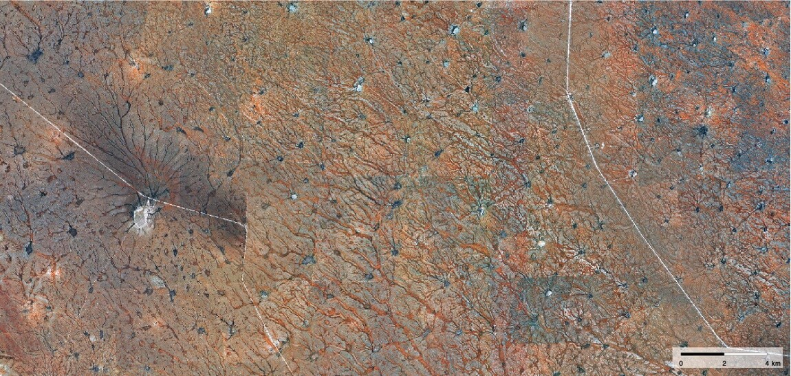
The Weissrand south and east of Mariental has a surface of calcrete pockmarked with dark grey dolines. These are shallow, funnel-shaped depressions into which rainwater drains, often having followed converging narrow drainage lines. These features are clearly seen in this satellite image. In some places the dolines have grown into large pans, such as the one shown here (centre left) with its many convergent drainage lines. [25.19° S, 18.37° E]
Pans

Just north of the main Etosha Pan are hundreds of tiny pans and drainage lines that, from above, give the landscape a magical quality, shaped like bizarre forms of life. The pans and drainage lines have formed through erosion of the extremely saline surrounding soils by water and wind. [18.31° S, 16.11° E]
Turbidites

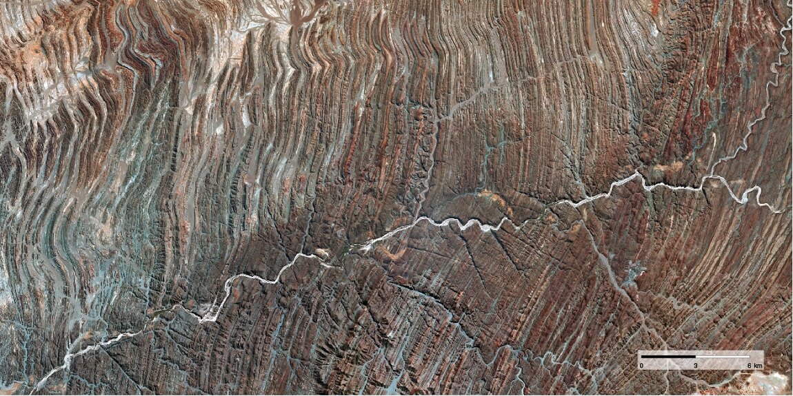
The folded rocks west and north of the Brandberg are known as turbidites. They were formed from sediments that accumulated on the edge of a continental shelf and, on reaching a critical mass, were shaken loose by tremors or earthquakes, causing the deposits to slump down in great mudslides to the ocean depths below. The layered sediments were later forced upwards, heated, squeezed and folded in processes that led to the formation of Gondwana. The folds vary in width from a few centimetres to hundreds of metres, decorating the landscape with extraordinary patterns. The white line in this satellite image is the Ugab River, which has cut through the turbidites. [20.95° S, 14.00° E]
Faults

Photo: O Ernst & H Baumeler
Namibia is relatively stable tectonically, with only minor seismic shifts being recorded sporadically. An exceptional movement caused the Hebron Fault, clearly seen in this photo. It can easily be traced 45 kilometres from end to end in the Sesriem area, notably along the D854 where this district road crosses the fault at 24.622 degrees south and 15.992 degrees east, or on the C19 road at 24.540 degrees south and 15.913 degrees east. The cliff of this small fault is 10 metres at its highest point. The most recent movement along the Hebron Fault was within the last 12,000 years. However, the fault was probably more active during much earlier times, and extensions of the Hebron Fault can be found along a stretch of 300 kilometres to the northwest and southeast.15

