

Types of vegetation
The types and abundance of vegetation in an area are largely determined by its climate, substrate and soils. The mix and wealth of plants, in turn, determine the products and services the vegetation offers and the profusion and forms of animal life it supports. Deciduous woodlands, for example, sustain forms of life different to those in grasslands, shrublands or floodplains. Having a knowledge of how vegetation varies from one place to another and the assemblage, structure and cover of plants found in various vegetation types is therefore useful. In pursuit of this, maps of vegetation at two scales are presented in the pages ahead: biomes and vegetation types.

Photo: N Pallett
Welwitschia mirabilis, an enigmatic plant restricted to the Namib Desert in Namibia and Angola.

Photo: J Pallett
Aloe erinacea, the 'spiny hedgehog', is endemic to southern Namibia.
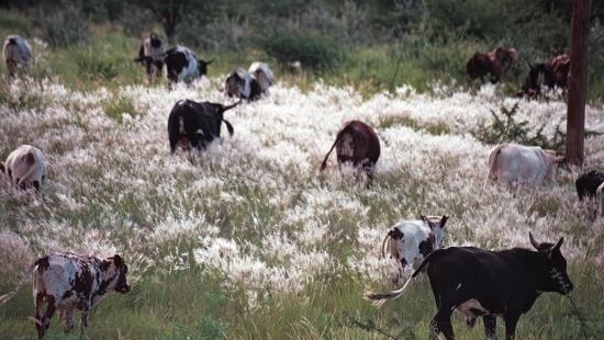
Photo: J Mendelsohn
Bushman grass, the common name for a few Stipagrostis species, sprouts and matures within weeks after good rain.
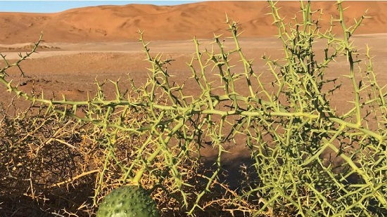
Photo: C Roberts
!Nara plants (Acanthosicyos horridus) mostly grow in deep sand close to ephemeral rivers in the Namib Desert.
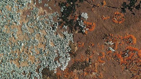
Photo: P van Schalkwyk
Lichens are not plants, but symbiotic composites of fungi and algae or cyanobacteria.

Photo: O Ernst & H Baumeler
The camel-thorn (Acacia erioloba) is a prominent icon in arid landscapes in southern and western Namibia.
6.01 Biomes in Africa1

Biomes are broad ecological units that share similar plant life, climate, soils, geomorphology and animal life. Africa can be divided into 13 biomes. North and south of the warm, humid and mostly forested equatorial central region, the biomes become progressively drier and the vegetation sparser with more deciduous, succulent and thorny plants, in line with decreasing rainfall and increasing evaporation. Generally, rain falls in the summer months – from April to October in the northern hemisphere, and from October to April in the southern hemisphere.
Biomes are broad ecological units that share similar plant life, climate, soils, geomorphology and animal life. Africa can be divided into 13 biomes. North and south of the warm, humid and mostly forested equatorial central region, the biomes become progressively drier and the vegetation sparser with more deciduous, succulent and thorny plants, in line with decreasing rainfall and increasing evaporation. Generally, rain falls in the summer months – from April to October in the northern hemisphere, and from October to April in the southern hemisphere.
6.02 Biomes and vegetation types in Namibia2

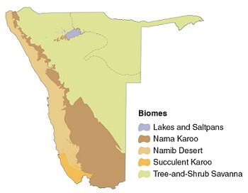
Five of Africa's 13 biomes are found in Namibia (figure 6.01); these five can be divided into 28 vegetation types. Two factors do much to determine the nature and boundaries of the biomes and vegetation types. First is the availability of water (which is largely an outcome of the competing effects of rainfall and evaporation), while the second is the type of soil. For example, Tree-and- Shrub Savanna can be broadly divided into two biomes in Namibia, where tall, broadleaved trees predominate in the wetter and sandy northeastern parts of the country, and acacias dominate the more arid southeastern areas. Taller trees and shrubs give way to shorter shrubs in the even drier southern and western areas of Namibia. Similarly, only grasses, shrubs and small trees do well on the shallow soils that cover hills in the central, southern and western highlands.
Few plants can root themselves in the shifting sands that make up much of the Namib Desert. Other more stable, stony or rocky parts of the Namib support various bulbs, herbs, grasses and small shrubs, while trees line ephemeral river courses that make their way westwards to the Atlantic Ocean.
Diverse communities of plants are supported by the Nama Karoo's various soils and geological substrates. These include dwarf shrubs, succulents and perennial grasses, and taller shrubs and trees along ephemeral drainage lines.
The great variety of plant species and subspecies – many of them endemic – found in the Succulent Karoo give this biome substantial importance for conservation. Succulents from diverse families are found in its many separate habitats, which include inselbergs, ranges of hills and plains of sand, gravel and gypsum.
Liambezi and the group of Omadhiya lakes are Namibia's only freshwater lakes in the Lakes and Saltpans Biome, but there are many saltpans on the coastal plain and clustered around Namibia's largest pan, Etosha which covers some 4,800 square kilometres. The few specialised plants that grow on the saltpans can withstand their very saline soils.

Photo: F Vassen
1 Central Desert

Photo: H Dillmann
2 Northern Desert
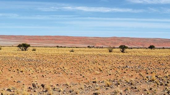
Photo: JB Dodane
3 Southern Desert
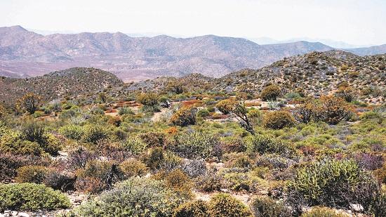
Photo: J Pallett
4 Succulent Steppe

Photo: P Lambrecht
5 Pans
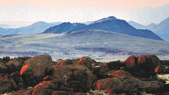
Photo: P Lambrecht
6 Central-Western Escarpment and Inselbergs

Photo: S Rankl
7 Desert – Dwarf Shrub Transition
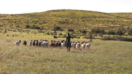
Photo: J Pallett
8 Dwarf Shrub Savanna
Photo: P Cunningham
9 Dwarf Shrub – Southern Kalahari Transition

Photo: M Serfling
10 Etosha Grassland and Dwarf Shrubland

Photo: J Mendelsohn
11 Karas Dwarf Shrubland
Photo: J Haylett
12 Northwestern Escarpment and Inselbergs

Photo: H Baumeler
13 Central Kalahari
Photo: J Mendelsohn
14 Cuvelai
Photo: JB Dodane
15 Highland Shrubland

Photo: F Wiese
16 Karstveld

Photo: JB Dodane
17 Mopane Shrubland
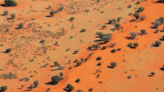
Photo: O Ernst & H Baumeler
18 Southern Kalahari

Photo: JB Dodane
19 Thornbush Shrubland

Photo: JB Dodane
20 Western Highlands
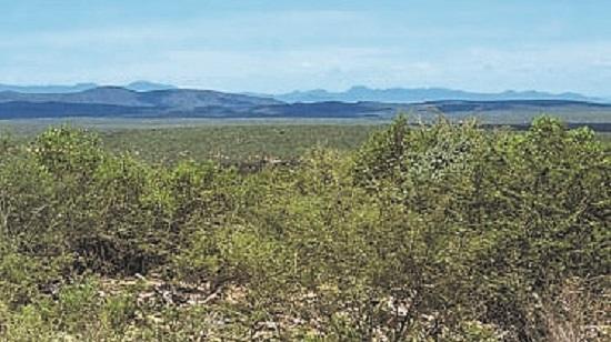
Photo: JB Dodane
21 Western Kalahari

Photo: J Mendelsohn
22 Northeastern Kalahari Woodland
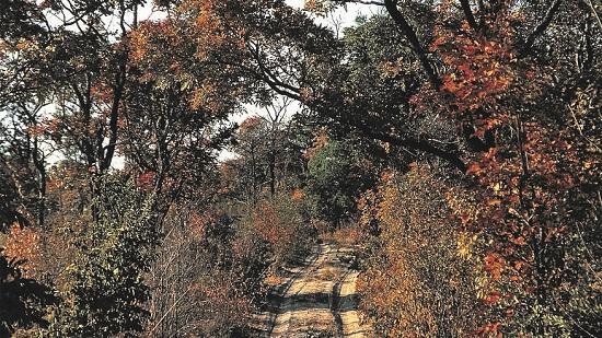
Photo: H Denker
23 Northern Kalahari

Photo: J Mendelsohn
24 Okavango Valley
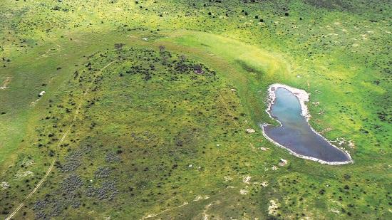
Photo: J Mendelsohn
25 Omatako Drainage

Photo: H Baumeler
26 Riverine Woodlands and Islands
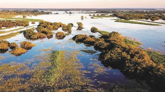
Photo: Gondwana Collection
27 Zambezi Floodplains

Photo: J Mendelsohn
28 Zambezi Mopane Woodland
6.03 Dominant types of soils, structure of plants and landscapes for Namibia's 28 vegetation types
| Vegetation type | Dominant soils | Dominant structure | Dominant landscape |
|---|---|---|---|
| 1 Central Desert | Gypsisols and Calcisols | Sparse shrubs and grasses | Mainly Central-Western Plain |
| 2 Northern Desert | Various | Sparse grasslands | Mainly Central-Western Plain |
| 3 Southern Desert | Arenosols | Grasslands and dwarf shrublands | Namib Sand Sea |
| 4 Succulent Steppe | Mainly Leptosols and Arenosols | Succulent shrubs | Coastal Plain |
| 5 Pans | Mainly Solonchaks | Pans and grasslands | Etosha Saltpans |
| 6 Central-Western Escarpment and Inselbergs | Various | Varied shrublands and grasslands | Central-Western Plain |
| 7 Desert – Dwarf Shrub Transition | Mainly Regosols and Leptosols | Low shrubs and grasslands | Coastal Plain, Nama Karoo Basin |
| 8 Dwarf Shrub Savanna | Mainly Regosols and Leptosols | Low shrubs | Nama Karoo Basin |
| 9 Dwarf Shrub – Southern Kalahari Transition | Mainly Arenosols and Leptosols | Grasslands and shrublands | Nama Karoo Basin |
| 10 Etosha Grassland and Dwarf Shrubland | Mainly Calcisols | Grasslands and low shrubs | Kalahari Sandveld |
| 11 Karas Dwarf Shrubland | Leptosols, Calcisols and Regosols | Grasslands and low shrubs | Various |
| 12 Northwestern Escarpment and Inselbergs | Mainly Leptosols | Varied shrublands and grasslands | Kaokoveld Hills |
| 13 Central Kalahari | Arenosols | Open acacia woodlands | Kalahari Sandveld |
| 14 Cuvelai | Cambisols and Calcisols | Floodplain grasslands or woodlands | Cuvelai |
| 15 Highland Shrubland | Leptosols and Regosols | Shrubs and low trees | Khomas Hochland |
| 16 Karstveld | Calcisols and Leptosols | Mixed woodlands | Karstveld |
| 17 Mopane Shrubland | Mainly Cambisols | Mopane shrublands and woodlands | Kalahari Sandveld |
| 18 Southern Kalahari | Arenosols | Open acacia woodlands | Kalahari Sandveld |
| 19 Thornbush Shrubland | Mainly Cambisols and Regosols | Acacia shrublands | Mainly Central-Western Plain |
| 20 Western Highlands | Leptosols and Regosols | Grasslands and scattered trees | Various |
| 21 Western Kalahari | Arenosols | Broadleaved woodlands | Kalahari Sandveld |
| 22 Northeastern Kalahari Woodland | Arenosols | Broadleaved woodlands | Kalahari Sandveld |
| 23 Northern Kalahari | Arenosols | Broadleaved woodlands | Kalahari Sandveld |
| 24 Okavango Valley | Fluvisols and Gleysols | Floodplain grasslands or woodlands | Kalahari Sandveld |
| 25 Omatako Drainage | Cambisols | Floodplain grasslands or woodlands | Kalahari Sandveld |
| 26 Riverine Woodlands and Islands | Fluvisols | Tall woodlands | Kalahari Sandveld and Northeastern Wetlands |
| 27 Zambezi Floodplains | Cambisols and Fluvisols | Floodplain grasslands | Northeastern Wetlands |
| 28 Zambezi Mopane Woodland | Cambisols | Grasslands or woodlands | Kalahari Sandveld |

Photo: R Droker
Armoured crickets (also called koringkrieke or Gobabis prawns) cool themselves in the gentle wind blowing through the tips of this Damara milkbush (Euphorbia damarana), a plant restricted to northwestern Namibia. Its latex is extremely poisonous to many animals and bacteria, but oryx and black rhino readily feed on the plants.
6.04 Land cover3

The mapping of vegetation types is one way of reflecting variation in plant life. There are other ways too, for example by mapping plant production, endemic plants and floristic areas and land cover.
Assessments of land cover over large areas are made using satellite images. There are many such assessments, as any internet search will demonstrate. All have strengths and weaknesses. Perhaps the best one for Namibia was produced recently using images captured by Sentinel satellites of the European Union's Copernicus Programme. This is shown here, but it too has inaccuracies. The extent of croplands is exaggerated in this set of land cover data, which serves as a reminder to check the accuracy of the many sets of mapped and other data now available on the World Wide Web. With few exceptions, publicly available data have reliable and useful aspects, but also unintended errors.
Despite these weaknesses, the map here accurately shows that much of Namibia is covered by bare ground in the most arid areas, and bush and shrubs in the remaining semi-arid areas. In the northern regions there are significant areas of woodland, and cultivated land that has been cleared of woodland and bush.

Photo: GIZ Bush Control and Biomass Utilisation Project
The starkest changes in land cover are often in farmland. This is where, for example, adjoining areas have been cleared for crops or used for grassland pastures (right half of photo), or allowed to become densely bushed (left).