

Evaporation and aridity
3.21 Annual potential evapotranspiration32

Evapotranspiration is measured as the amount of moisture released to the atmosphere through evaporation from surfaces such as the soil, wetlands and standing water combined with transpired moisture lost from plants via their leaves, stems and flowers during photosynthesis. Potential evapotranspiration is a measure of the ability of the atmosphere to remove water through evapotranspiration processes. Using potential rather than actual evapotranspiration provides a means of determining the water balance of a particular area as it indicates the amount of evaporation that would occur if sufficient water were available. The calculations make use of several parameters including rainfall, average temperature, daily temperature range and extraterrestrial radiation.
In arid areas, potential evapotranspiration exceeds annual precipitation and this is depicted clearly in this map where the average values in most areas are an order of magnitude higher than the average levels of rainfall received (figure 3.07). To put this in context, all the water in a full, uncovered, average size public swimming pool would evaporate before a year has past. The parts of the country with the greatest potential for evapotranspiration are in the east and southeast, which are also the areas that experience the greatest annual and daily temperature extremes (figures 3.15 and 3.17).
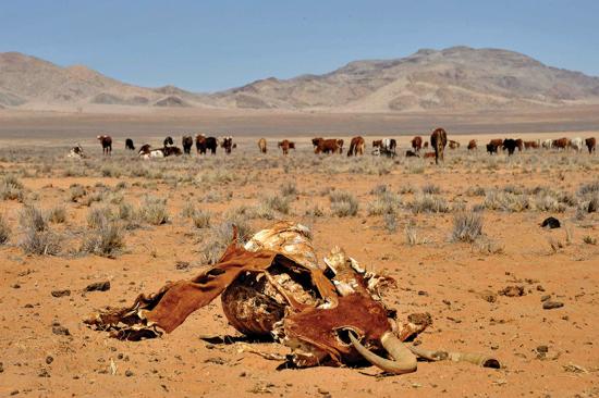
Photo: NACSO/WWF in Namibia
The water deficit makes cattle farming a hazardous exercise, particularly if faced with consecutive years of low rainfall that result in heavy losses.
3.22 Namibia's aridity index33

The Global Aridity Index is the ratio between rainfall and potential evapotranspiration. Consequently, an index value of 1 would mean that the amount of potential moisture lost is exactly offset by the amount of rainfall received. This classification system considers values above 0.5 as increasingly humid, while values below 0.5 represent more arid conditions.
In Namibia, the highest index values of 0.20 or more occur along the far northern and northeastern margins of the country, and in the Tsumeb area. In terms of the Global Aridity Index these areas are considered semi-arid. The bulk of the rest of the country has an index of 0.02–0.20 and is considered arid, while the entire coastal belt is hyper-arid. It is of no surprise therefore that much of the country is ill-suited for many forms of livestock or crop farming, especially in combination with Namibia's poor soils (figure 5.17).