

Place names
1.06 The meaning of place names7
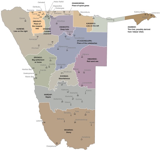
The name 'Namibia' is derived from the word 'Namib', which describes a vast open space in Khoekhoegowab, the Nama and Damara language. Some place names in Namibia have been in use for hundreds of years, while others were assigned more recently. The derivations of the names of the 58 places numbered in the map above are given in the following table.
| 1 | Arandis | The place where people cry |
| 2 | Aranos | 'Ara' (from the name 'Arahoab') and 'nos' (from the town's location on the Nossob River) |
| 3 | Aroab | Aro (Ziziphus mucronata) and '!ab' (river) |
| 4 | Berseba | Oath at the well; or seven wells |
| 5 | Bethanie | House of misery |
| 6 | Bukalo | Where people live |
| 7 | Divundu | Marsh |
| 8 | Eenhana | Stockade for calves |
| 9 | Gibeon | After Gibeon, a city of the Old Testament |
| 10 | Gobabis | Place of strife or argument (from 'Khoabes') |
| 11 | Gochas | Place with many Acacia hebeclada shrubs |
| 12 | Grootfontein | Large fountain |
| 13 | Helao Nafidi | After Helao Nafidi, a military commissar |
| 14 | Henties Bay | After Hendrik 'Henty' van der Merwe, who came across the bay in 1929 on his search for water |
| 15 | Kalkrand | Limestone ridge |
| 16 | Kamanjab | The place of the big stones |
| 17 | Karasburg | Stony mountain |
| 18 | Karibib | From |karibi (nut grass) |
| 19 | Katima Mulilo | To quench the fire |
| 20 | Keetmanshoop | Keetman's Hope |
| 21 | Khorixas | Mustard tree (Salvadora persica) |
| 22 | Koës | Place of villains; meat from the shin; or grey go-away-bird (Corythaixoides concolor) |
| 23 | Leonardville | After Reverend EJ Leonard |
| 24 | Lüderitz | After Adolf Lüderitz, who 'bought' the bay in 1883 |
| 25 | Luhonono | After the luhonono tree (Terminalia sericea) |
| 26 | Maltahöhe | Malta's heights |
| 27 | Mariental | Maria's valley |
| 28 | Nkurenkuru | Old (or original) home |
| 29 | Okahandja | Plain or flat place |
| 30 | Okahao | Calabash |
| 31 | Okakarara | Also known as Erari (flat area); rara or rar- denotes sleep |
| 32 | Okongo | A place or a forest for hunting |
| 33 | Omaruru | Place of bitter milk |
| 34 | Omuthiya | Camel-thorn tree (Acacia erioloba) |
| 35 | Ondangwa | Place of the Ndonga |
| 36 | Ongwediva | Where leopards drink |
| 37 | Oniipa | Thick skin, after fruits of the African ebony tree (Diospyros mespiliformis) |
| 38 | Opuwo | Enough |
| 39 | Oranjemund | Mouth of the Orange [River] |
| 40 | Oshakati | Centre |
| 41 | Oshikuku | Sandy place |
| 42 | Otavi | Water spurting from the spring, like milk from a cow's udder when a calf nurses roughly |
| 43 | Otjinene | Large place |
| 44 | Otjiwarongo | Beautiful place |
| 45 | Outapi | Burning place (also Uutapi) |
| 46 | Outjo | Small hill |
| 47 | Rehoboth | Broad place or room |
| 48 | Ruacana | The rapids |
| 49 | Rundu | High place |
| 50 | Stampriet | Stamped reeds |
| 51 | Swakopmund | Swakop after the Khoekhoegowab Tsoaxaub for excrement, probably because the Swakop River spews brown water into the sea when in flood. 'Mund' is German for river mouth. |
| 52 | Tsandi | Named after Otsandi, a nearby water source |
| 53 | Tses | Place of daylight |
| 54 | Tsumeb | From tsoumsoub, to dig in loose ground, and otjisume, place of frogs |
| 55 | Usakos | The place that grasps the hoof (from the clingy yellow clay at local water sources) |
| 56 | Walvis Bay | Whale bay |
| 57 | Windhoek | Windy corner; alternatively, might have been named after 'Winterhoek' in the Cape |
| 58 | Witvlei | White marsh |
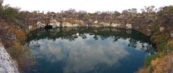
Photo: Ikiwaner (https:// commons. wikimedia.org/ wiki)
'Oshikoto' means 'a deep hole', a reference to Lake Otjikoto near Tsumeb. The lake was an underground aquifer which became exposed when its roof of rock collapsed.

Photo: J Mendelsohn
'Omusati' is Oshiwambo for mopane (Colophospermum mopane), the abundant hardwood trees found in arid rocky areas of northwestern Namibia and on alluvial soils in the Cuvelai.
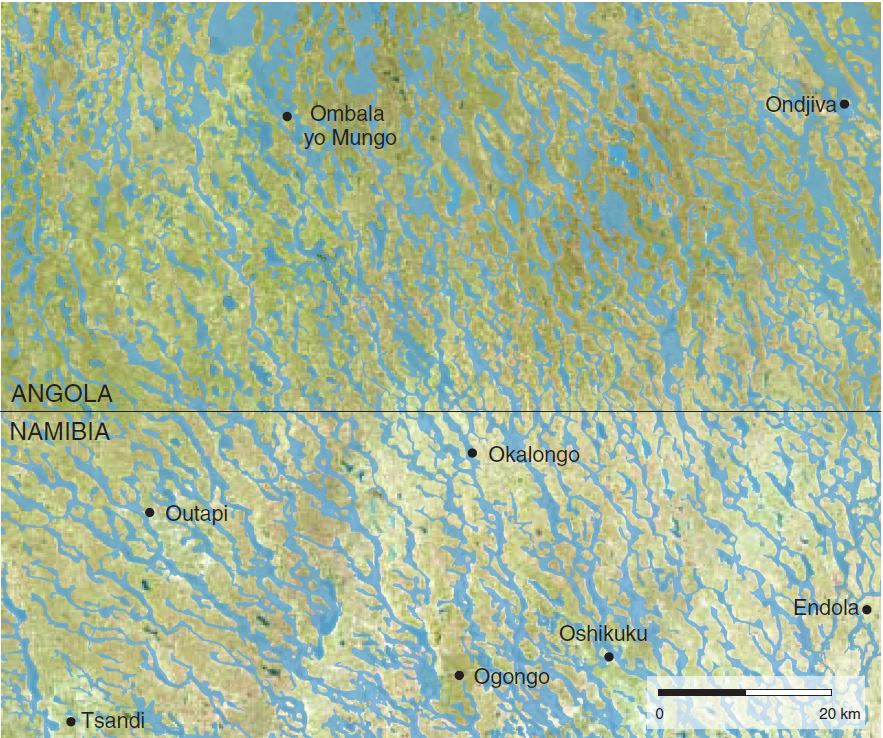
Photo: RadarSat data March 2011, European Space Agency
Oshana is the singular form of 'iishana' in Oshiwambo. It refers to a network of about 100 shallow channels of the Cuvelai drainage system that periodically flow with runoff from Angola.

Photo: C Begley
Omaheke is named after the red windblown sands that cover much of eastern Namibia. In places the sands have been moulded by the wind into parallel dunes.

Photo: Google Earth and Bing images via Terraincognita, draped over Shuttle Radar Topography Mission data
The names of the Erongo Region and Erongo Mountains are derived from the Otjiherero word oshirongo, which is a large home or settlement.

Google Earth and Bing images via Terraincognita, draped over Shuttle Radar Topography Mission data
The names Hardap Region and Hardap Dam come from the Khoekhoegowab term har'dup for nipple. Just behind Hardap Dam lies Mariental and green fields irrigated with water from the dam.
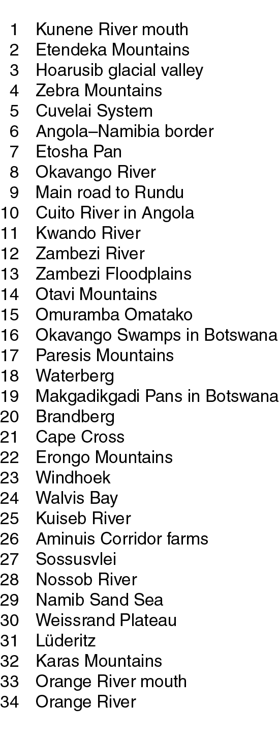
A view of Namibia from space
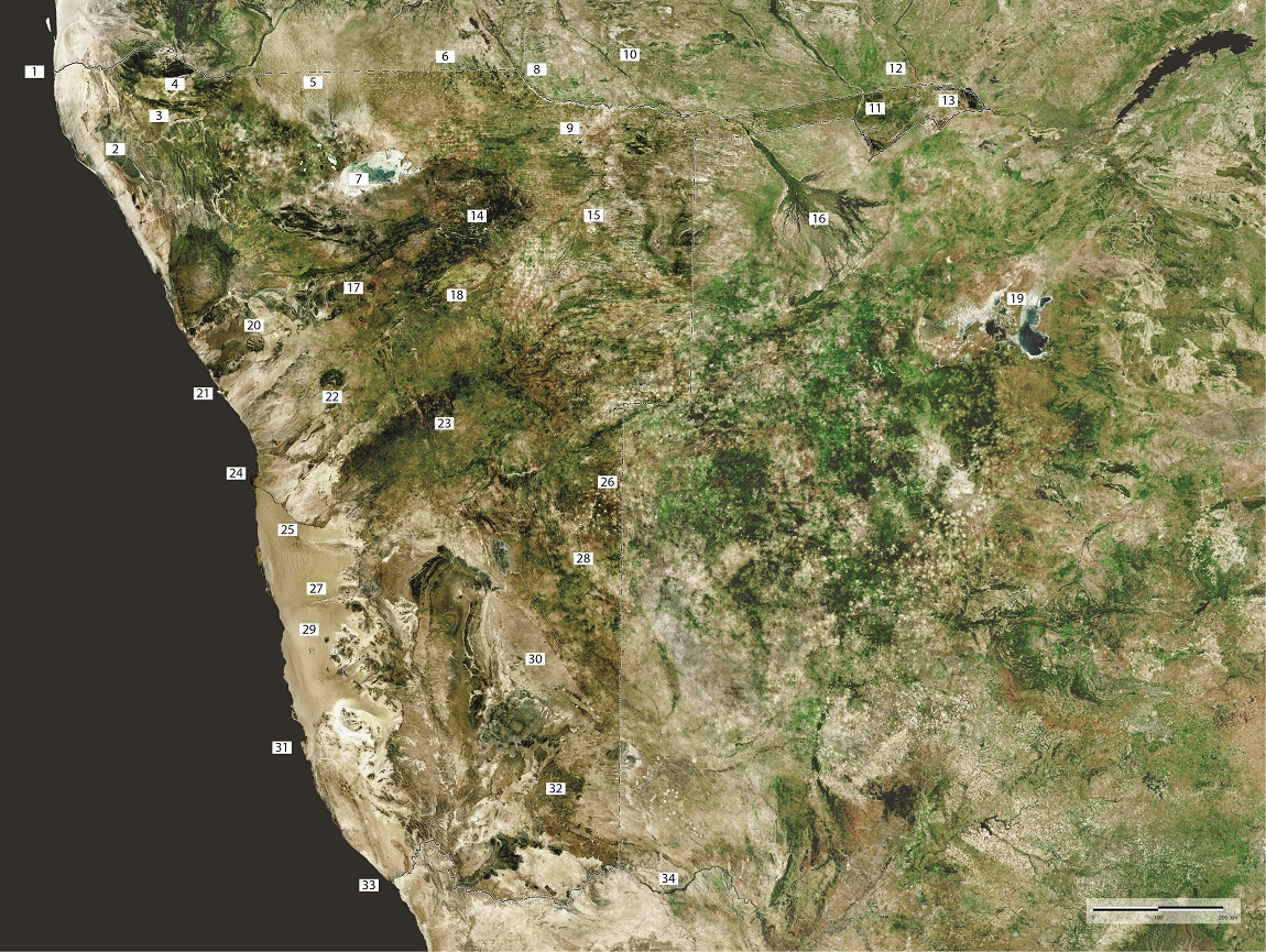

Namibia is often clearly visible from the air or space because its landscapes are seldom obscured by clouds, dust or haze, and thanks to its arid climate there is little dense or tall vegetation to cover the ground. In a nutshell: there is much to see. Flying over Namibia, or studying aerial photos or satellite images, is like reading a book: each scene is packed with fascinating facts, stories and imagery; each image reveals an account of formation, climate, foundation, topography, life and how the land has been used. This view of Namibia from space is a mosaic of images captured from a Landsat satellite orbiting above the earth. It clearly shows many of Namibia's major features and landscapes; some of them are labelled.