

Fourth period, post-Gondwana: 132 million years ago to now
The final period in Namibia's geological history leading to its present-day physical form is largely a continuation of processes that stemmed from the break-up of Gondwana as Africa and South America split. The final shaping of the landscapes of Namibia began with rivers carrying eroded material down to the South Atlantic Ocean that formed when the two continents separated. The coastal plain thus expanded as elevated inland areas were eroded and lost ground, progressively withdrawing eastwards. That process continues today at a slow, imperceptible pace.
The expanding coastal plain holds many geological remnants of times long past, such as inselbergs, faults and dykes. The composition of its surface is however largely a product of the weather and ocean currents present along the Namibian coast. These maintain its aridity, drive sand across its surface and polish its rocks. The Orange River, in combination with the Benguela Current, has also had a major impact on the coast, supplying the sand that accumulates as coastal dunes, as well as the diamonds that have added so much to Namibia’s economy. The quantity of sand and diamonds deposited onshore would have been much reduced if it were not for the wide continental shelf on which they could settle before being carried northwards.
Earth, 80 million years ago
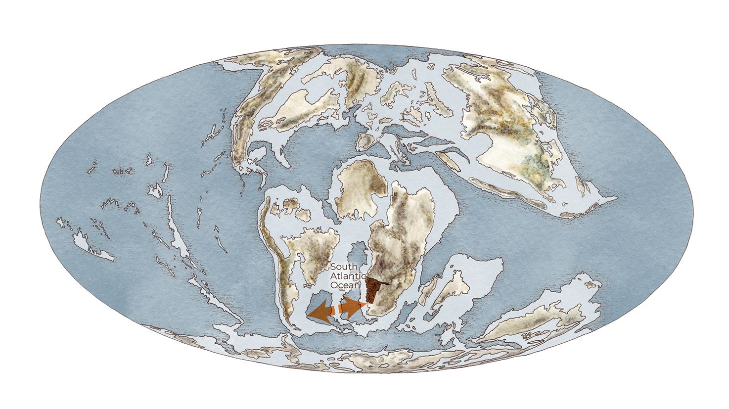
Sediments from rivers in Namibia are eroded into the emerging and widening South Atlantic Ocean. The mid-Atlantic ridge continued to erupt new material as Africa and South America drifted away from one another.
2.20 Post-Gondwana geology, 132 million years ago to the present
The most significant event marking this final period was the uplift of the margins of southern Africa, which resulted in the creation of a massive basin covering much of central southern Africa – the Kalahari Basin. Rivers and wind have eroded the margin of highlands into the basin ever since. Alluvial sediments were prevalent during the occasional wet periods, but most sediments were deposited by wind during the arid conditions that have dominated most of the last 60 million years. Evidence for this is found in the ancient dunes preserved under the modern dunes of the Namib Desert, for example.
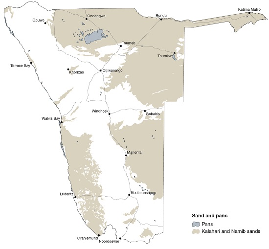
The map shows the surface of aeolian sands that cover most of the Kalahari Basin and the Namib Sand Sea. Only Etosha Pan and a few other nearby pans are shown here, but there are thousands of pans elsewhere in Namibia.
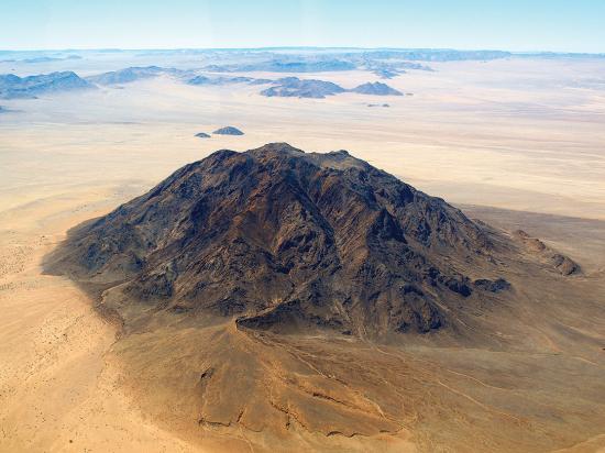
Photo: H Baumeler
Dikke Willem is well known as a landmark along the road between Aus and Lüderitz. It has another distinction, which is its composition as a carbonatite, an igneous rock that generally emerges as dykes or sills. Carbonatites are rich in carbonate minerals, some of which can have commercial value. Dikke Willem emerged about 49 million years ago and now stands about 500 metres above the surrounding plains.19